Wisconsin DNR Expands Turkey Research with Trapping and GPS Tracking
EDGEFIELD, S.C. — The Wisconsin Department of Natural Resources is currently wrapping up its second and final season of turkey trapping for a population monitoring project. The project — led by Chris Pollentier, upland game bird research scientist at WIDNR — uses a variety of surveys to monitor wild turkey recruitment and track population trends. The study utilizes and builds on the Snapshot Wisconsin trail camera network, a citizen-science project with over 2,000 cameras across the state. The project is supported by the NWTF’s national RFP program and a $50,000 contribution from the Wisconsin NWTF State Chapter.
"The WIDNRs Snapshot Wisconsin network is the largest set of wildlife cameras across the landscape in the country, and for them to use it to obtain important wild turkey management information is a great example of how technology and conservation can go hand in hand,” said Clayton Lenk, NWTF district biologist. “This is such an innovative approach to gather important information and the Wisconsin NWTF State Chapter is beyond proud to endorse it.”
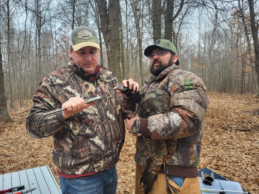
The WIDNR’s trapping efforts expanded on the use of these trail cameras by placing wing tags on all captured birds and outfitting hens with GPS/VHF transmitters, enabling them to track nesting behavior, brood survival and movements. Despite challenges brought on by a warmer than usual winter in 2024, the project has been successful.
"To date, we’ve obtained 25,000 plus GPS locations and nearly 3,000 trail camera photos,” Pollentier said. “We’ve trapped 40 hens and 19 males. We have four GPS-marked hens that have survived from last year, bringing our current total to 44 hens with transmitters. Our goal is to deploy all 60 transmitters we have.”

By analyzing this data, wildlife managers will be able to make evidence-based decisions that maintain stable and healthy turkey populations across Wisconsin’s seven turkey management zones. The research will also help estimate poult survival rates and provide deeper insights into turkey behavior and habitat preferences. These findings can inform future decisions regarding harvest seasons and permit availability. Additionally, monitoring long-term turkey population trends will help detect early declines, allowing for proactive conservation efforts. The ability to track habitat preferences will also improve management strategies to better support wild turkeys in the state.
Most importantly, this research has already helped to improve our understanding of turkey movements and behavior.
While monitoring a hen, Pollentier was surprised by how much she moved with day-old poults on the landscape.
“I expected them to hatch and maybe go a quarter of a mile to the brood-rearing area until they were older,” he said. “We had birds that were literally moving on a daily basis, following ditch streams, traveling a mile in one day, and then the next day, for whatever reason, she would turn a different way and go another mile. I was surprised to see that; I would have never thought that.”
Pollentier and his team also tracked a bird that moved 12 miles from where they caught her.
“Sharing this data with folks has been eye opening and exciting,” Pollentier said.
All birds that are captured are given a leg band with his phone number. If a bird is harvested, the hunter can call him.
“I give them the lowdown on the life history of that bird, and then I can ask them how they came across it,” he said. “We had one tom that was harvested last year, and the guy called, and I talked to him for at least 20 minutes about the project, and then I told him where we caught that bird. It was probably three miles away from where he had harvested, and he was really surprised that the bird had even moved that far. Those conversations I have are awesome, because then he talks to his buddies and word spreads, and you eventually form a community.”
CONNECT WITH US
National Wild Turkey Federation
770 Augusta Road, Edgefield, SC 29824
(800) 843-6983
National Wild Turkey Federation. All rights reserved.
